GPS PLATFORM
GPS PLATFORM
Web GIS and Cloud Computing for the management of airport mobile resources
GEOGATE is a tool that combines Web technologies, GIS and GPS to manage the activities of ground handling at airports. GEOGATE uses GPS / GPRS technology to locate, monitor and map the resources, WEB GIS to manage geo-referenced information and cloud computing to achieve flexibility and robustness of the network. GEOGATE provides the following functions:
FUNCTION
- Mapping and Resource Management: Stand, parking, gate, trolleys, ladders
- Monitoring of vehicles: Position, stop time, speed, distance between vehicles
- Vehicle check: Opening doors, fuel consumption, crash detection
- Alarm management: Speed Limit, entrance and parking in prohibited areas/hours
- Real time dash board: Synthesis motion data, vehicle status, driving behavior of driver
INFORMATION FEED BACK
- Position and direction of shuttle bus and luggage transport vehicles at a given time;
- “Stop time” position of a vehicle with respect to aircraft or other controlled object;
- Distance between two objects at a given time;
- Identification and enabling of the driver through the use of personal badge according to the set parameters;
- Crash detection achieved with the sensors.
TAXATION RECOVERY
Geotrace will soon be certified to record the parameters set out in Circular 5/D of the Customs Dept: hours of work and engine rpm. Infact the vehicles which are not homologated for use on public roads or approved with restrictions may obtaine, thanks to the installation of Geotrace, a refund of taxation paid on fuel purchased.
ALARMS DETECTED
- Detection of vehicles that exceed a set speed;
- Sudden accelerations/decelerations;
- Detection of vehicles that trespass a defined area;
- Detection of vehicles that trespass a defined area;
- Detection of vehicles parked in prohibited areas or at a prohibited time;
- Detecting of simultaneous presence of unauthorized vehicles in defined areas.

MAINTENANCE MANAGEMENT
Another key feature for handling agents is to manage the maintenance of their vehicles.
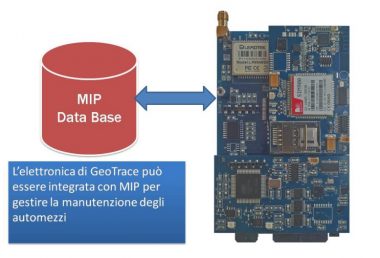
GEOGATE has been integrated with MIP software through the electronics installed on vehicles to monitor the status of vehicles, auto activating necessary maintenance or to warn staff of technical problems.
MIP SOFTWARE
Objectives of the software
- Management of Preventive Maintenance
- Management of maintenance inspection
- Management of breakdowns
- Management of breakdowns with constraints
- Management of ticketing
Options
- Analysis of the state of the vehicles
- Registry of maintenance carried out
- Registry of maintenance carried out on tires
- Tire rotation management


